
I drove to the general area of the dedication, where I found some home-made cardboard signs with directions to the dedication. After driving 16 miles up a logging trail on a mountain west of Rangeley Maine, I got to the dedication site, which to my surprise was apparently also the crash site.
Turns out it was for AC# 43-38023, which was a B-17 apparently
was on it's way from Nebraska on it's way to Dow Field Maine from
where it would have go on to the war, on July 11 1944.
Unfortunately, apparently the crew got lost. According to the
speaker, the plane was last contacted by radio from Grenier Field (now
Manchester airport), before it got lost, and wasn't heard from again.
They were apparently WAY off course. Rather than being near
Bangor, they were over near the NH/Canada border on the other side
of the state, and instead of being over relatively flat terrain, they were
over an area dotted with 3000-5000' mountains around lakes at approximately
1500' . There was apparently a 1000' ceiling that day (ie the mountain
peaks were in the clouds) , and since they didn't know where they
were, they circled for two hours (according to witnesses on the ground
who heard the plane going around and around), apparently waiting for the
clouds to clear. The clouds didn't clear. They tried
to come down to see some landmark on the ground only to see a mountain
in front of them. Apparently they tried to turn and climb, but the
right wing
hit, and the plane cart wheeled, and broke up into tiny pieces.
It took them days to find the site, and days more to get there, but
there was little left. Other than the few crew remains that were
taken back to Dow Field, what remained of the wreckage was left on the
site.
Decades later, a logging company un-earthed the
wreckage while building the logging road we drove in on. They
dug a big hole, and bull dozed the remains into the hole. Trees grew
over the site. Apparently recently, a storm uprooted some big trees
that had grown over the site, and when the roots came up, so
did parts of the plane. This is apparently what inspired the
group up there to build the memorial, which is a nice stone marker
way back in the woods, with the name of the unfortunate crew. The
group that did the dedication had no connection to the AAF or the plane
that crashed (in fact they mis-identified it as a B-17-J when it is actually
a B-17-G), but they had great respect for the crew that lost their lives
for their country, which was very moving. A few pictures were
taken at the site, first, a view of the color guard that participated in
the program.
Once we got to the crash/memorial site, we snapped a picture of the
stone with the
color guard behind it.
A close-up of the stone
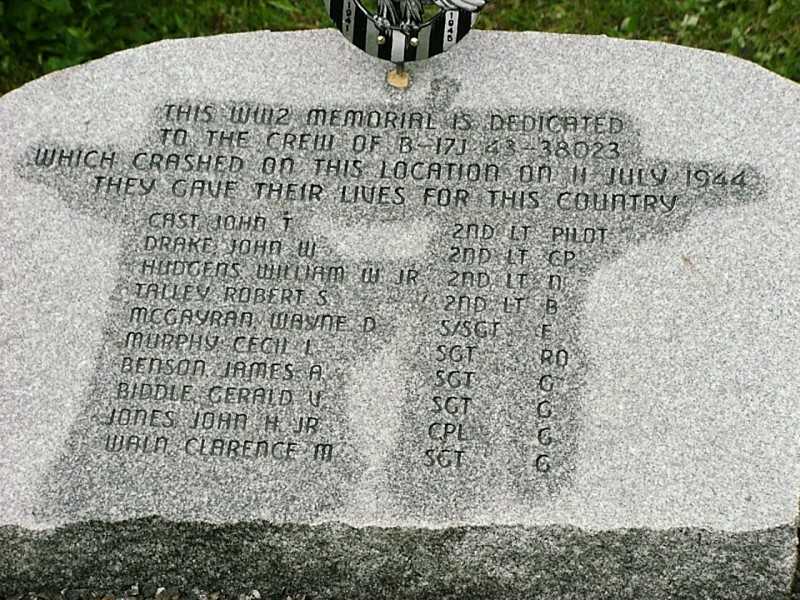
shows the crew names that were lost on the plane.
Someone there had a xerox copy of 4 photos of the
crash site taken from the air back
in 1944.
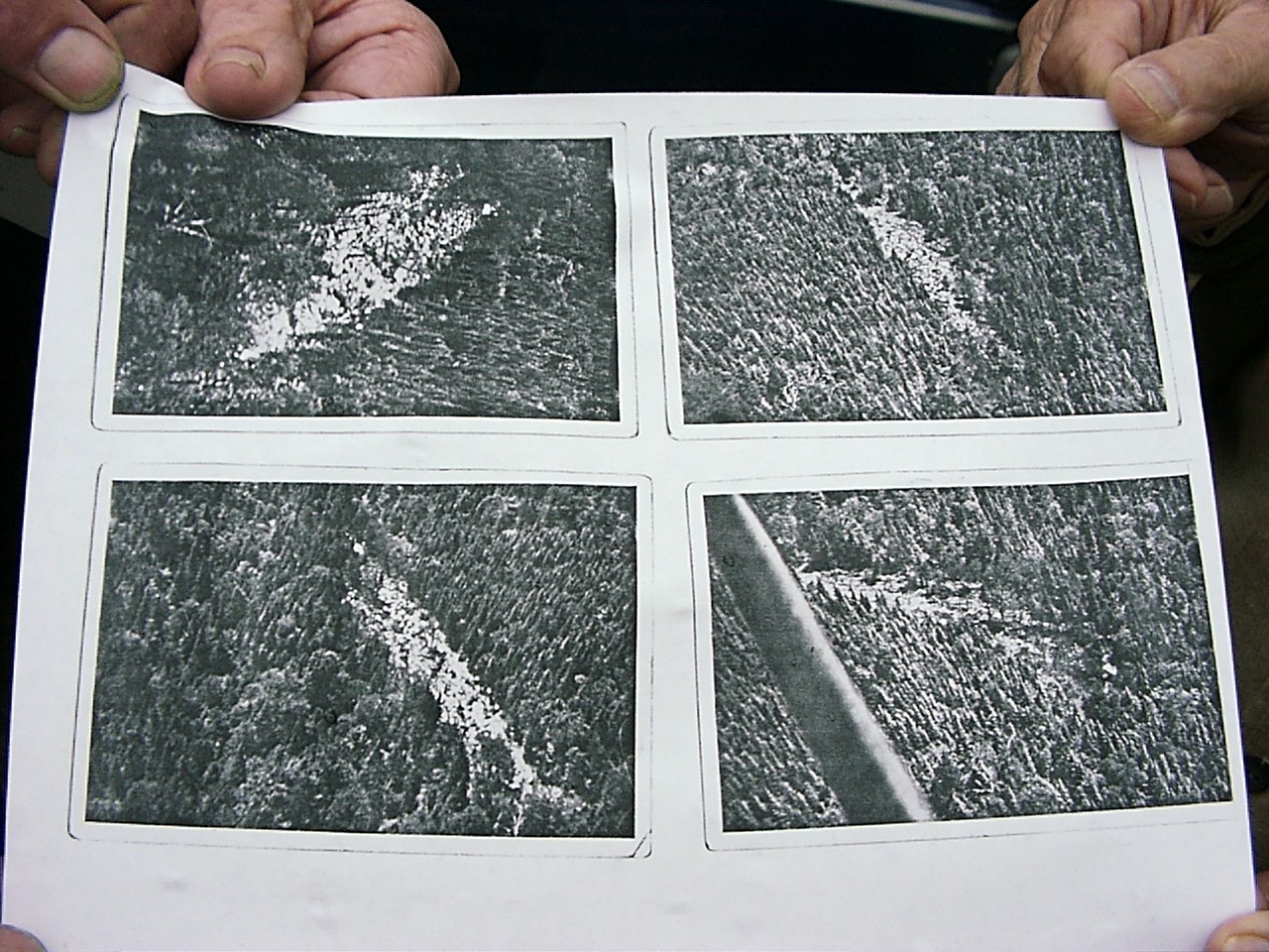
The quality is pretty poor, being a photo of a Xerox of a photo, but
you can see that there wasn't much left of the
plane, as things are scattered over a wide area. The impact area was
supposed to be something like a couple hundred feet wide, by a quarter
mile long. Now there is a logging road through the area, and the trees
aren't as tall, since it was logged since then. Pretty much all of
the wreckage is apparently still there, but much of it is underground.
However they
sent out a couple small kids to see what they could find, and an assortment
of remnants were found:
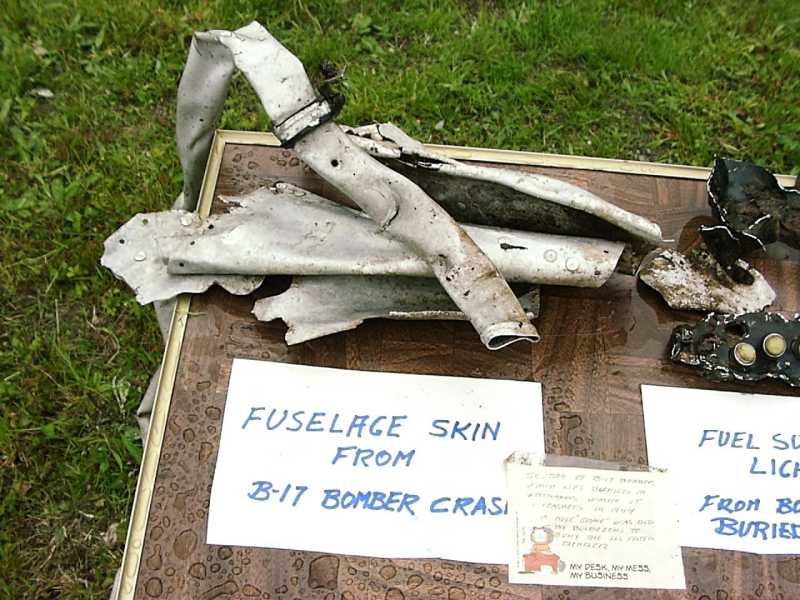
I knew about the existence of this crash site,
but not it's location or the story behind it, so I
had imagined a nearly whole carcass of a plane remaining. I had
no idea that only
small pieces would remain.
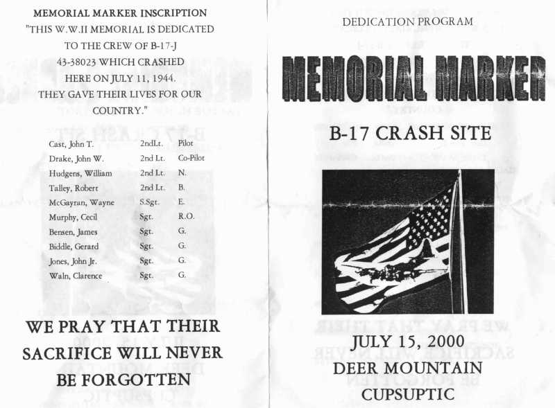
The dedication ceremony was quite moving, despite the rain that was falling at the time. A program was given out, part of which is shown below.
The crash site is only about 15 miles north
west of Rangely. On the way back, we stopped at a
roadside overlook of the Rangely area, and you could see the crash
mountain, which is
Deer Mountain.
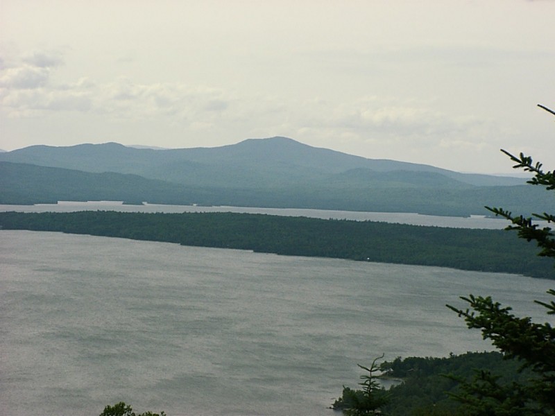
The mountain is a 3500' mountain, and the crash site is
at about 2900'. The lakes below are
at about 1500'. Picture is taken from rt 17, about 15 miles southeast
of the mountain.
It is not often that one gets the chance to visit the crash site of
a W.W.II era bomber, and it is well worth the effort.